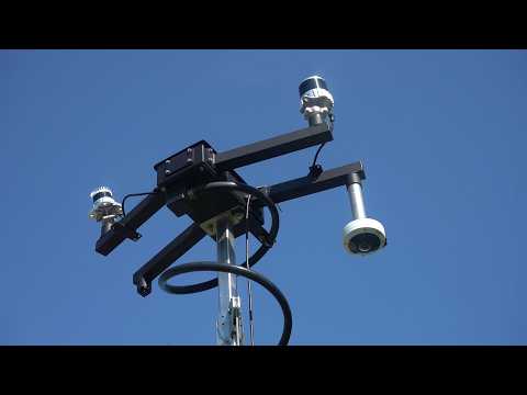
The Hillen Road & 33rd Street Intersection Analysis uses infrastructure-based LiDAR sensing to document traffic operations and safety conditions at a heavily traveled intersection near Morgan State University. Situated adjacent to Lake Montebello, the intersection links a major north-south corridor (Hillen Rd.), an east-west neighborhood connection (E 33rd St.), and a park-access roadway system, generating a dense mix of vehicle, pedestrian, and bicycle movement.
Using a LiDAR sensor mounted at the intersection, researchers collected data from October to November 2025 to measure multimodal volumes, vehicle operating speeds, near-conflict events, and pedestrian crossing behavior. During the study period, the intersection processed an average of approximately 25,700 vehicles per day alongside consistent pedestrian and bicycle activity. The analysis applies Post-Encroachment Time (PET) as a surrogate safety metric to pinpoint the most critical interactions, distinguishing vehicle-to-vehicle conflicts along the Hillen Road corridor from vehicle-to-pedestrian and vehicle-to-bicycle conflicts concentrated in east-west movements.
The report further examines out-of-crosswalk crossings and connects them to specific roadway features, including a west-side median, the absence of a marked north-south crossing on the east leg, and pavement markings that do not align with physical curb and sidewalk boundaries. It concludes with near-term, low-cost measures and longer-term infrastructure recommendations designed to improve safety and predictability at the intersection.
Universities Involved
Morgan State University
Principal Investigators
Dr. Mansoureh Jeihani
Abolfazl Taherpour
Completion Date
July 2026
Expected Research Outcomes & Impacts
The project delivers quantitative, location-specific evidence to guide targeted safety improvements at the Hillen Road and 33rd Street intersection. Anticipated outcomes include countermeasures tailored by conflict type, improved pedestrian crossing predictability through geometric and signage upgrades, and a repeatable model for using infrastructure-based LiDAR to evaluate operational safety at other intersections in the region. The findings equip planners and traffic engineers to prioritize both near-term, low-cost actions and longer-term capital improvements.
Subject Areas
Traffic safety, Intelligent transportation systems, Multimodal mobility, Infrastructure-based LiDAR sensing